
DJI Terra is a 3D model reconstruction software that has photogrammetry as its core technology. It supports a range of accurate and efficient 2D and 3D reconstruction of visible light, and data processing through DJI LiDAR. DJI Terra is a perfect match for DJI Enterprise drones and payloads. It works in conjunction to build a complete application solution that caters to vertical scenarios such as land surveying and mapping, power transmission, emergency services, construction, transportation, and agriculture.
Generate realistic 3D models and point cloud results quickly from photos. AI technology now automatically optimizes water surfaces in the model. Users can now use Customized Mesh Simplification to simplify model meshes. Users can export formats commonly used in multiple industries for image reconstruction in diverse scenarios, such as surveying and mapping, accident sites, power grid equipment, and progress-tracking for construction projects. View the main features click here.
DJI Terra and 2D Maps
Rapidly generate high-precision True Digital Orthophoto (TDOM) and Digital Surface Model (DSM) from photos. The algorithm is optimized according to the different scenarios to significantly improve processing efficiency, effectively avoid image warping and deformation, and obtain detailed and accurate measurement results for all your target objects and survey areas. It meets the needs of various scenarios such as mapping, land surveying, natural resource and urban planning, emergency response, agricultural route planning, and more.

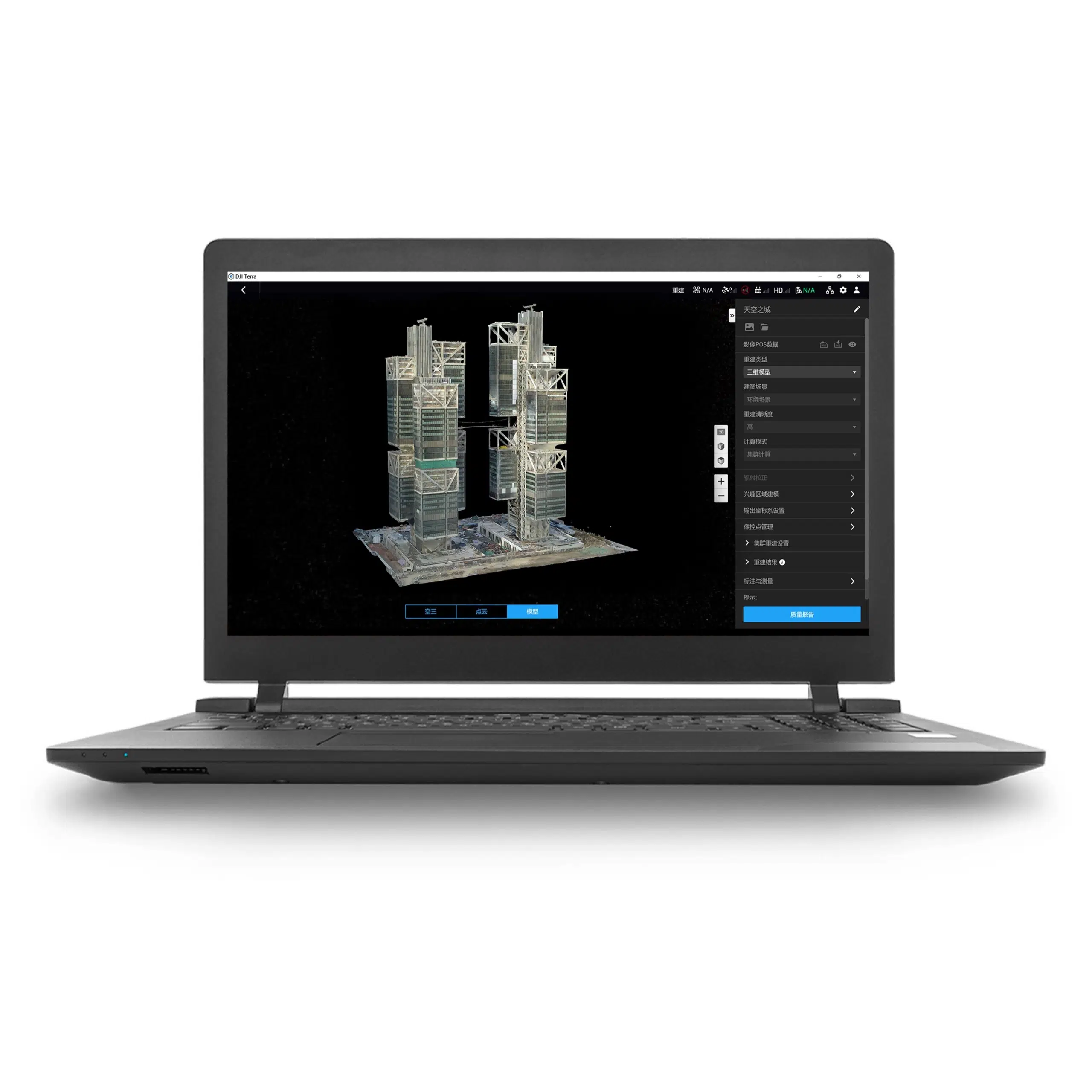
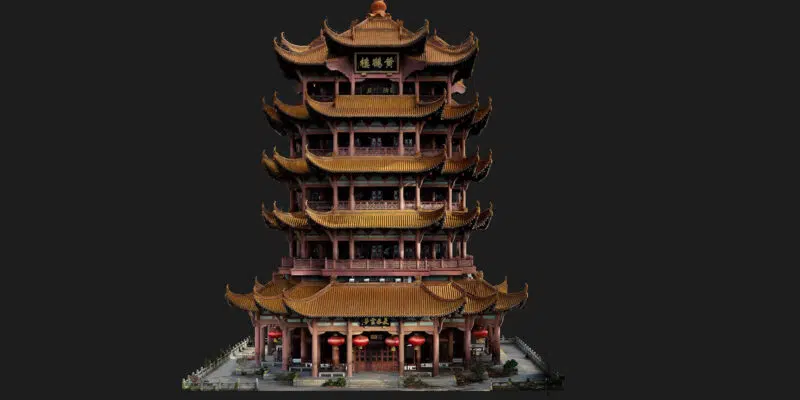
DJI Terra and 3D Models
Generate realistic 3D models and point cloud results quickly from photos. AI technology now automatically optimizes water surfaces in the model. Users can now use Customized Mesh Simplification to simplify model meshes. Users can export formats commonly used in multiple industries for image reconstruction in diverse scenarios, such as surveying and mapping, accident sites, power grid equipment, and progress-tracking for construction projects. View the video tutorial.
LiDAR
With just one click, you can perform highly accurate processing of the point cloud data captured by the Zenmuse LiDAR in DJI Terra. The data undergoes trajectory computation and point cloud accuracy optimization, enabling the direct generation of various standard formats of 3D point clouds. After ground point classification, it can output DEM (Digital Elevation Model) and contour results. Importing control points allows for accuracy control, resulting in high-precision point cloud outputs. Quality reports and profile inspection functions facilitate point cloud quality analysis. In the event of unexpected RTK real-time differential data loss, the DJI Terra PPK function can still match offline base station data to reconstruct high-precision models.

