

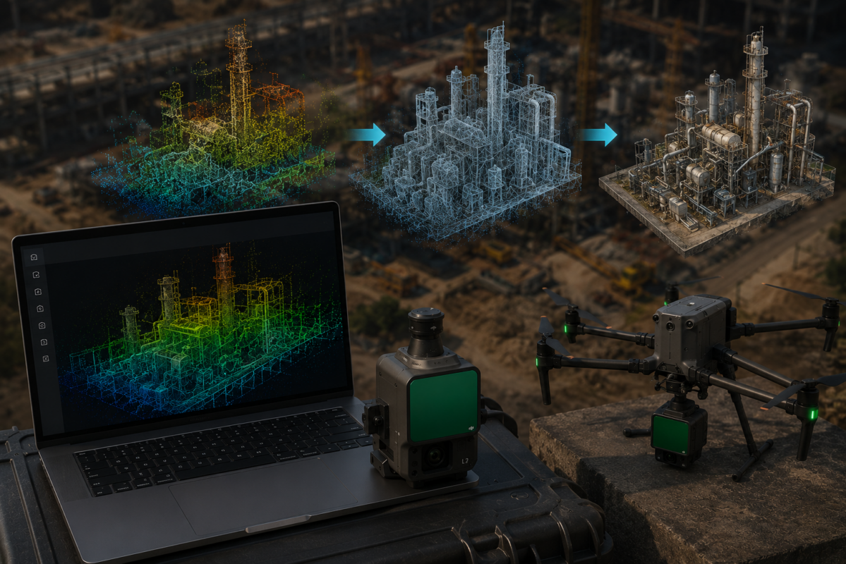
DJI TERRA 3D RECONSTRUCTION GUIDE
Choose the right 3D output for your drone project
DJI Terra Gaussian Splatting creates a 3D representation designed for realistic scene visualization. It is particularly relevant when a client needs to explore a captured site, understand its appearance or review complex structures from different viewpoints.
This guide explains how it differs from a mesh or point cloud, which license supports photo-based reconstruction, how to plan a practical workflow and what to check before delivering the result.
A drone project can require several deliverables: a scene for presentation, a point cloud for technical analysis, or a map for a GIS workflow. Choosing Gaussian Splatting should start with the intended use and the recipient’s software. A convincing visual result and a validated survey deliverable require different acceptance checks.
What is 3D Gaussian Splatting?
3D Gaussian Splatting, often shortened to 3DGS, represents a scene using many small Gaussian elements with properties that describe their position, shape, opacity and appearance. A compatible renderer combines these elements to show the scene from a chosen viewpoint.
This is different from a conventional mesh, which represents surfaces with connected polygons. It is also different from a survey point cloud: the Gaussian elements are part of a rendering representation, rather than simply a collection of measured XYZ points.
The original 3D Gaussian Splatting research project explains the underlying approach. DJI Terra provides its own product workflow; performance figures from research demonstrations should not be treated as Terra processing benchmarks.
What does DJI Terra add?
DJI documents photo-based Gaussian Splatting reconstruction in Terra, including 3D scene creation and orthomosaic generation. Its product page highlights visually complex subjects such as vegetation, fine structures and reflective or transparent surfaces.
The useful question is whether it represents the features that matter to your project. For example, a scaffold may be important to a site presentation, while the position of a wall corner may be important to a dimensional survey. Assess each against its intended purpose.
Gaussian Splatting vs mesh, point cloud and orthomosaic
These outputs can complement one another. Agree the deliverable before acquisition so that the capture, processing and validation support the same objective.
| Output | Typical purpose | Main delivery check |
|---|---|---|
| Gaussian Splatting scene | Visual exploration, scene presentation and stakeholder review. | A renderer that supports the exported representation; inspect required viewpoints. |
| 3D mesh | A polygonal surface for compatible modeling, editing and visualization tools. | Geometry, textures, units and destination application support. |
| Point cloud | Survey analysis, classification and a reference for CAD or BIM workflows. | Coverage, density, coordinate reference and independent accuracy checks. |
| Orthomosaic / elevation raster | Plan-view mapping or surface analysis, according to the selected output. | Resolution, georeferencing, height reference where applicable, and completeness. |
For a construction example: use a Gaussian Splatting scene to communicate how the captured site looks. If a designer also needs a survey reference, agree a suitable point cloud or surface deliverable and validate it separately. Our DJI Terra to Revit guide explains a point cloud workflow for BIM use.
Which DJI Terra license supports Gaussian Splatting?
The official DJI Terra feature list includes Gaussian Splatting 3D reconstruction and DOM generation from visible-light photographs in Flagship and Cluster. These functions are not marked as included in Standard or Agriculture.
For a standalone photo-based Gaussian Splatting workflow, assess DJI Terra Flagship. LiDAR point cloud processing is a separate feature in the matrix; its availability does not establish access to photo-based Gaussian Splatting.
Read our Standard vs Flagship comparison and DJI Terra license guide before selecting a product. For an existing license, verify the active entitlement and the installed software version rather than relying only on an older product name.
What workstation do you need?
DJI’s Gaussian Splatting FAQ lists Windows 10 or Windows 11, at least 4 GB of GPU memory and 32 GB of system RAM. Its broader Terra requirements specify a compatible NVIDIA GPU. These are minimum requirements, rather than a capacity recommendation for every dataset.
Budget for the working images, processing files and final deliverables as well as memory. Run a representative test on the intended workstation before accepting a large project or promising a processing deadline. Our system requirements and workstation guide covers the hardware planning stage.
Plan the image capture before reconstruction
The following acquisition checklist is practical guidance for planning a project, rather than a universal DJI flight prescription. Select the mission geometry and settings against your site, camera, safety constraints and required coverage.
- Define the viewing area. List the facades, roof edges, structures or landscape features the recipient must be able to inspect.
- Capture several useful directions. A set of downward-looking images may leave vertical surfaces poorly observed. Where appropriate and permitted, plan oblique coverage of important features.
- Maintain sufficient overlap. Avoid isolated viewpoints and gaps between capture sequences. Test a representative area rather than assuming one overlap setting suits every subject.
- Keep images sharp. Check motion blur, focus and exposure in the original files before leaving the site.
- Limit changes during capture. Moving vehicles, people, wind-driven vegetation and changing illumination can complicate scene reconstruction.
- Record the project reference. Keep positioning data and any required survey control with the dataset. Confirm the coordinate handling of the specific processing and export workflow.
Verify your acquisition system against our supported drones and sensors guide. Aircraft compatibility, image suitability and access to a reconstruction feature are separate checks.

A practical DJI Terra Gaussian Splatting workflow
Exact controls can change between releases. Use the manual for your installed version; the sequence below focuses on the decisions and checks that make a reconstruction usable.
1. Agree the deliverable and acceptance criteria
Confirm who will open the scene, which software they will use, the area to cover and the views that matter. If the same project includes measurements, specify the separate survey outputs and validation requirements.
2. Check the license and processing environment
Confirm access to the required reconstruction feature, supported hardware and adequate working storage. Complete activation before the processing deadline; our installation and activation guide explains that preparation.
3. Review and organize the source data
Preserve the original dataset and work from a clearly identified project copy. Inspect blurred images, exposure changes and missing coverage. Keep a record of any exclusions so that a colleague can understand what entered the reconstruction.
4. Run a representative reconstruction
Select the appropriate photo-based Gaussian Splatting workflow in the installed version. Start with a coherent test area that contains difficult features, rather than only the easiest part of the site. Inspect the result before committing to the full dataset.
5. Inspect the complete scene
Review the required viewpoints, scene boundaries, transitions between areas and small structures. Compare questionable regions with their source photographs. Record missing coverage and visual artifacts instead of concealing them with a single flattering camera angle.
6. Export and test the recipient’s workflow
Export the agreed representation, retain the required supporting files and open it in the intended viewer. Deliver a short handover note with the capture date, software version, reference information, known limitations and opening instructions.
Export formats, DJI Reality and web viewing
DJI’s Terra product documentation lists PLY and B3DM / 3D Tiles exports for Gaussian Splatting. Check the options provided by your installed release and the exact requirements of the destination renderer.
A file extension is only part of compatibility
A Gaussian Splatting PLY needs its scene attributes to be interpreted by a suitable renderer. A tool that opens an ordinary point-cloud PLY does not necessarily render a Gaussian scene correctly. Likewise, general 3D Tiles support is not sufficient evidence that an application can display Terra’s Gaussian representation.
Before a full handover, ask the recipient to open a small exported example. Check appearance, scene position and performance. Preserve the complete export structure and its metadata rather than assuming one file is always sufficient.
Use DJI Reality for model review
DJI describes Reality as a PC model viewer. The official FAQ lists TerraGS for Gaussian scenes, alongside supported mesh and point-cloud formats. Download it from the official DJI Terra downloads page and check the documented import workflow for the exported dataset.
Web integration needs a compatible renderer
DJI documents a TerraGS extension for CesiumJS. A web delivery plan should include renderer support, hosting, dataset transfer and testing on the devices that stakeholders will use. Exporting a scene alone does not create a hosted interactive website.
Where does DJI Modify fit?
The official feature list describes Modify’s mesh and point-cloud editing capabilities. Choose an editing tool against the actual data type and supported operations. Mesh repair or LAS editing capabilities do not, by themselves, establish support for editing Gaussian splats.
Applications and quality checks
Construction and stakeholder communication
A navigable scene can help explain site context, access routes and visible progress. For repeated visits, record capture dates and coverage differences so viewers understand which areas can reasonably be compared.
Heritage, architecture and complex structures
Use a sample reconstruction to assess whether the representation communicates facades, intricate features and the surrounding environment. Keep the source photographs available when a detail needs closer review.
Site review and digital twin presentation
A captured 3D scene can be a visual component of a larger system. Define how it will relate to asset records, coordinates and other datasets. A realistic scene alone does not supply an asset database or an automatically updated digital twin.
If the project requires measurements
Specify the required accuracy and coordinate reference, then validate the relevant deliverable using independent checks. RTK positioning or control data can support a workflow, but do not automatically prove the accuracy of every exported representation. Our accuracy, GCP and RTK guide explains the difference between control and independent verification.
Pre-delivery checklist
- Required areas and viewpoints are present and have been inspected.
- Artifacts, incomplete coverage and changing objects are documented.
- The recipient can open the complete export in the agreed application.
- Coordinates, units and reference information are checked where relevant.
- Any survey accuracy claims are supported by validation of the specified output.
- Source data, export settings and the delivered revision are archived.
Common problems and troubleshooting
The result looks good from one angle but poor from another
Compare the affected views with the acquisition coverage. A facade or overhang seen from too few useful directions may need additional capture. Inspect both nearby and wider viewpoints before approving a fix.
There are floating artifacts or inconsistent objects
Check for moving subjects, blurred images and changes during acquisition. Use a small test to establish whether the problem relates to the source data, a processing choice or the renderer, rather than rerunning the whole project without a diagnosis.
The export opens as points or looks incorrect
Verify support for the Gaussian representation and its attributes. Test the documented DJI viewing workflow, then compare the third-party import. Keep the export files and metadata together.
Reconstruction or viewing is too slow
Separate processing performance from viewer performance. Review the dataset size, available memory, GPU compatibility, driver and free storage. Use a representative sample to estimate the workload; a minimum specification does not establish a delivery time.
For a broader diagnostic approach, read our DJI Terra reconstruction errors guide. Record the software version, error message and stage of failure before requesting help.
DJI Terra Gaussian Splatting FAQ
Is Gaussian Splatting always better than a mesh?
Choose against the task. Compare appearance on a representative scene, then consider the recipient’s editing or analysis requirements. A visual advantage does not establish compatibility with a mesh-based workflow.
Can I use DJI Terra Standard for photo-based Gaussian Splatting?
The current feature matrix assigns photo-based Gaussian Splatting to Flagship and Cluster. Check the active entitlement when upgrading an existing installation.
Can a Gaussian scene replace my survey point cloud?
Only if it satisfies the agreed use, format and validation requirements. Where the recipient requests a measured point-cloud reference, supply that deliverable rather than assuming a Gaussian scene is interchangeable.
How long will reconstruction take?
Estimate it from a representative dataset on the intended workstation. Image count, resolution, scene complexity and the processing configuration can change the workload. Record the test conditions with your estimate.
Can I open the result in any PLY viewer?
Verify Gaussian attribute and renderer support. General PLY import is not proof of correct Gaussian Splatting rendering.
Should I change my drone just to use Gaussian Splatting?
First assess whether the existing camera and capture plan can supply suitable data, whether the processing feature is licensed, and whether the intended deliverable passes a sample test. Decide on new acquisition hardware against a demonstrated project requirement.
Plan your DJI Terra 3D workflow
Tell us your acquisition system, intended output and the software your client will use. We can help assess the Terra licensing and processing requirements for that workflow.
Official documentation and references
- DJI Terra product documentation: reconstruction features and Gaussian Splatting exports.
- DJI Terra and DJI Modify feature list: edition entitlements and editing capabilities.
- Official DJI Terra FAQ: hardware, DJI Reality and TerraGS integration.
- DJI Terra downloads and documentation: current installers, manuals and release information.
- Original 3D Gaussian Splatting research: background on the rendering representation.
Independent guide published by Drone Emotions, the business behind djiterrasoftware.com. Documentation reviewed on 8 October 2026. Feature availability and supported workflows should be checked against the installed release and applicable license.


