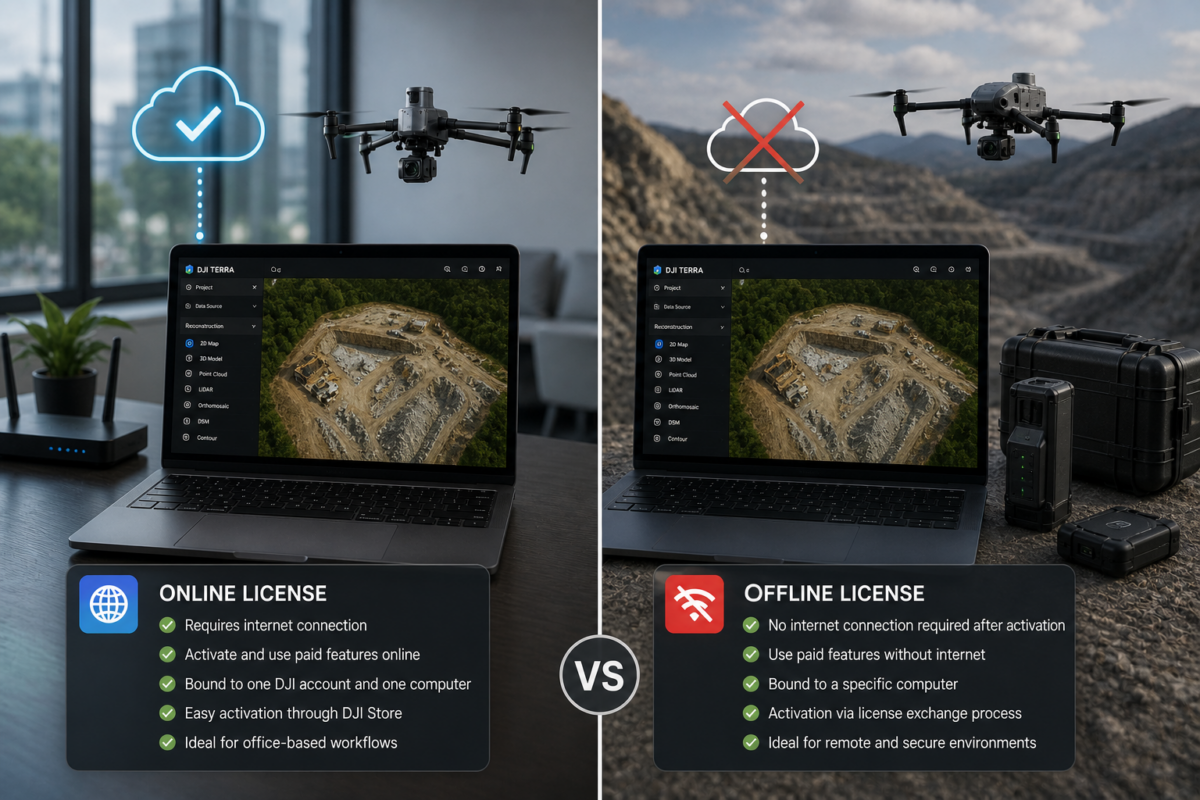
Choosing between a DJI Terra offline license and an online license is an important decision for companies using DJI Terra for drone mapping, surveying, construction, infrastructure inspection, LiDAR processing, agriculture or 3D reconstruction. The difference is not only about activation. It affects internet requirements, device binding, security policies, IT management, remote operations and long-term workflow
Author Archives: admin
06
May
May
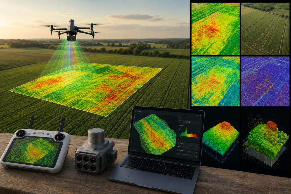
DJI Terra is not only a drone mapping and 3D reconstruction platform for surveying, construction and infrastructure. It can also play an important role in precision agriculture, especially when used with multispectral drones such as the DJI Mavic 3 Multispectral or Phantom 4 Multispectral. For farmers, agronomists, cooperatives and agricultural drone service providers, DJI Terra
06
May
May
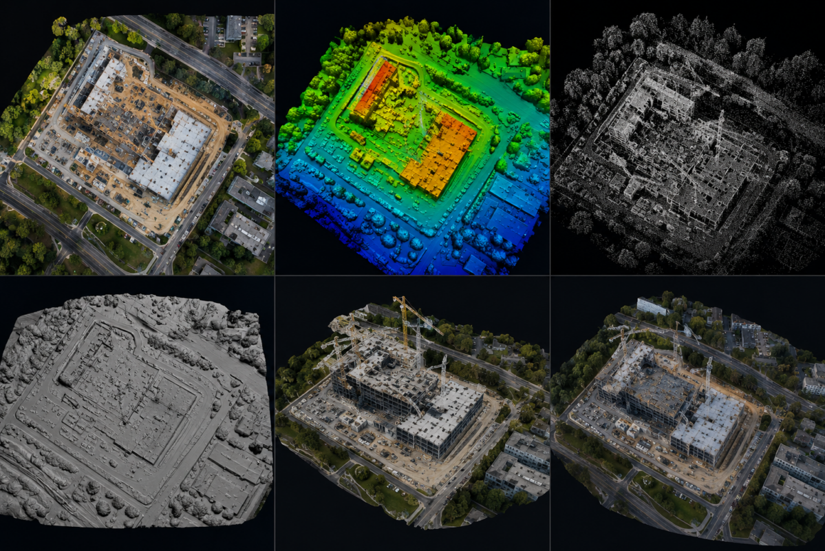
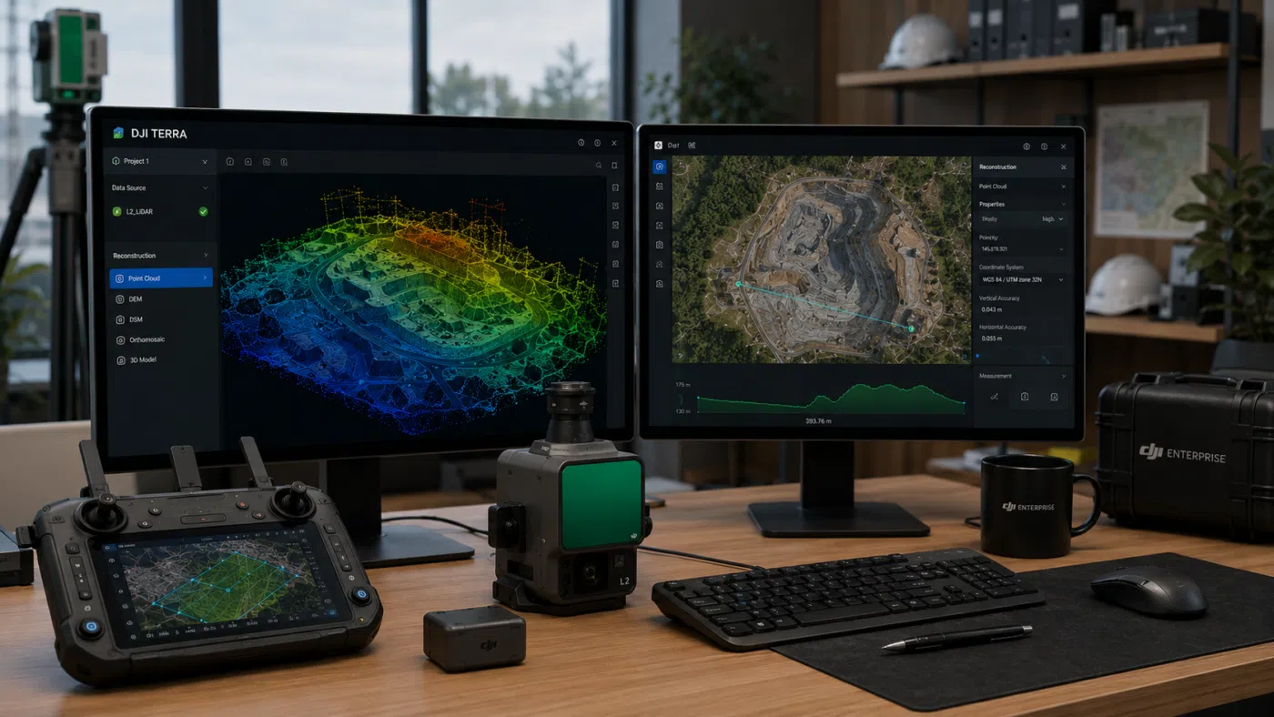
DJI Terra can generate several different outputs from drone imagery and LiDAR data, but many new users are not always sure what each output actually means. Terms like orthomosaic, DSM, DEM, point cloud, mesh and 3D model are often used together, but they are not the same thing. Each output has a different purpose, format,
06
May
May
The DJI Matrice 4E is one of the most important compact enterprise drones for professional mapping, surveying, construction and mining workflows. Designed specifically for geospatial applications, it combines a mapping-oriented camera system, mechanical shutter, RTK capability and intelligent flight features in a portable platform. When paired with DJI Terra, the Matrice 4E becomes a powerful
06
May
May
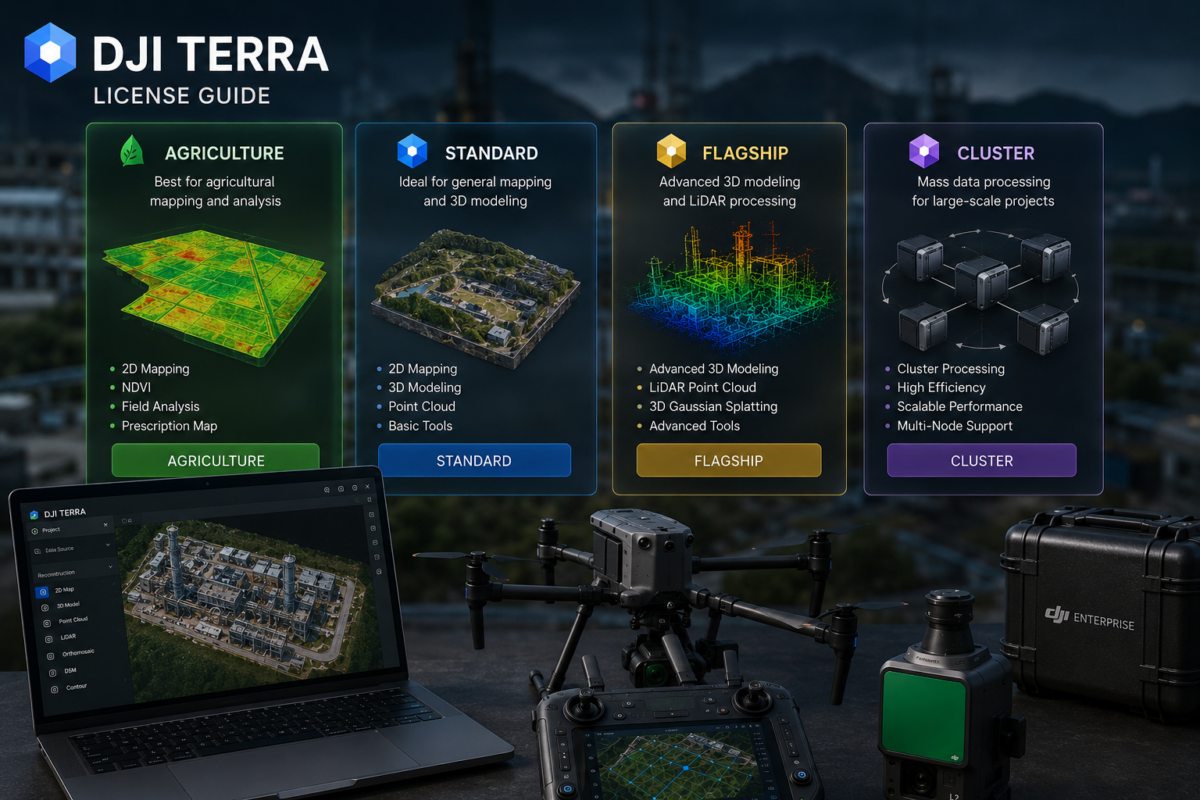
Choosing the right DJI Terra license can be confusing, especially for new users who are trying to understand the differences between Standard, Flagship, Agriculture and Cluster versions. DJI Terra is a professional software platform for drone mapping, 2D reconstruction, 3D reconstruction, LiDAR point cloud processing and advanced 3D modeling workflows. However, not every license is
06
May
May
Drone modeling is entering a new phase. For years, professional drone mapping has mainly focused on orthomosaics, point clouds, textured meshes, digital surface models and LiDAR datasets. These outputs remain essential for surveying, engineering, construction, inspection and GIS workflows. However, a new reconstruction technology is changing how professionals think about 3D visualization: 3D Gaussian Splatting.
06
May
May
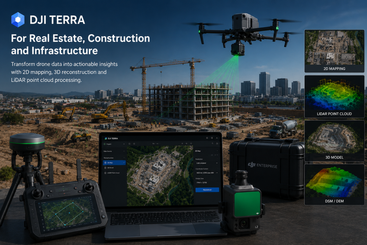
DJI Terra is becoming one of the most useful software platforms for professionals who need to transform drone data into practical digital deliverables. For real estate developers, construction companies, engineering firms, infrastructure operators and drone service providers, DJI Terra can help convert aerial imagery and LiDAR data into 2D maps, 3D models, point clouds, terrain
06
May
May
DJI Terra has become one of the most important software platforms for professionals using DJI drones in surveying, mapping, construction, infrastructure inspection, mining, forestry and 3D reconstruction. As DJI continues to improve Terra with 2D mapping, 3D reconstruction, LiDAR point cloud processing, 3D Gaussian Splatting and integration with DJI Modify and DJI Reality, many professionals
06
May
May
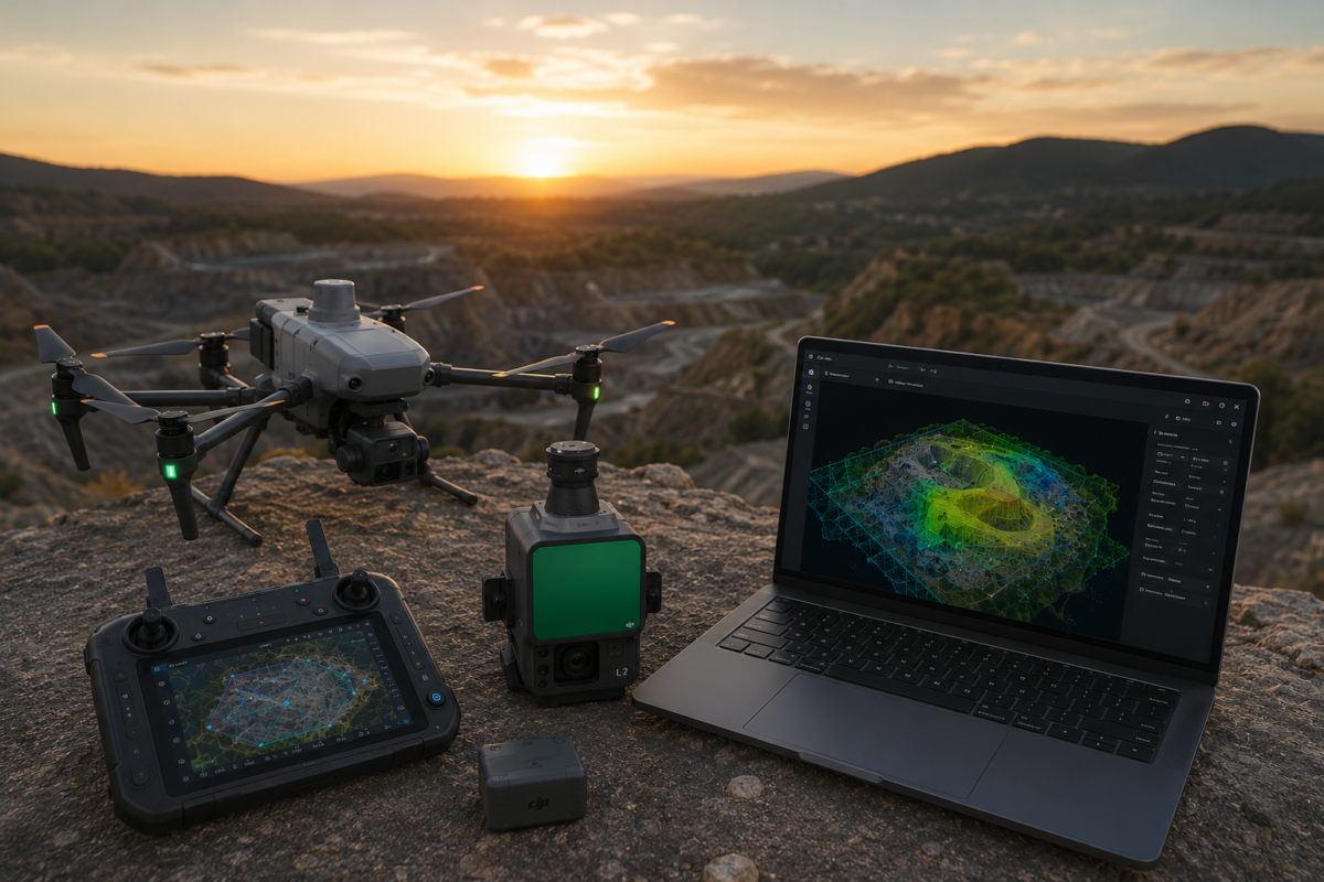
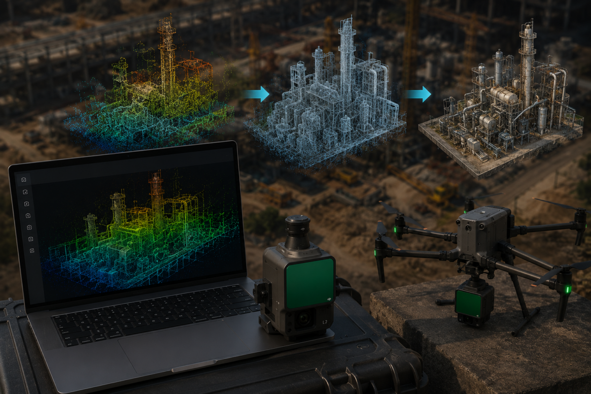
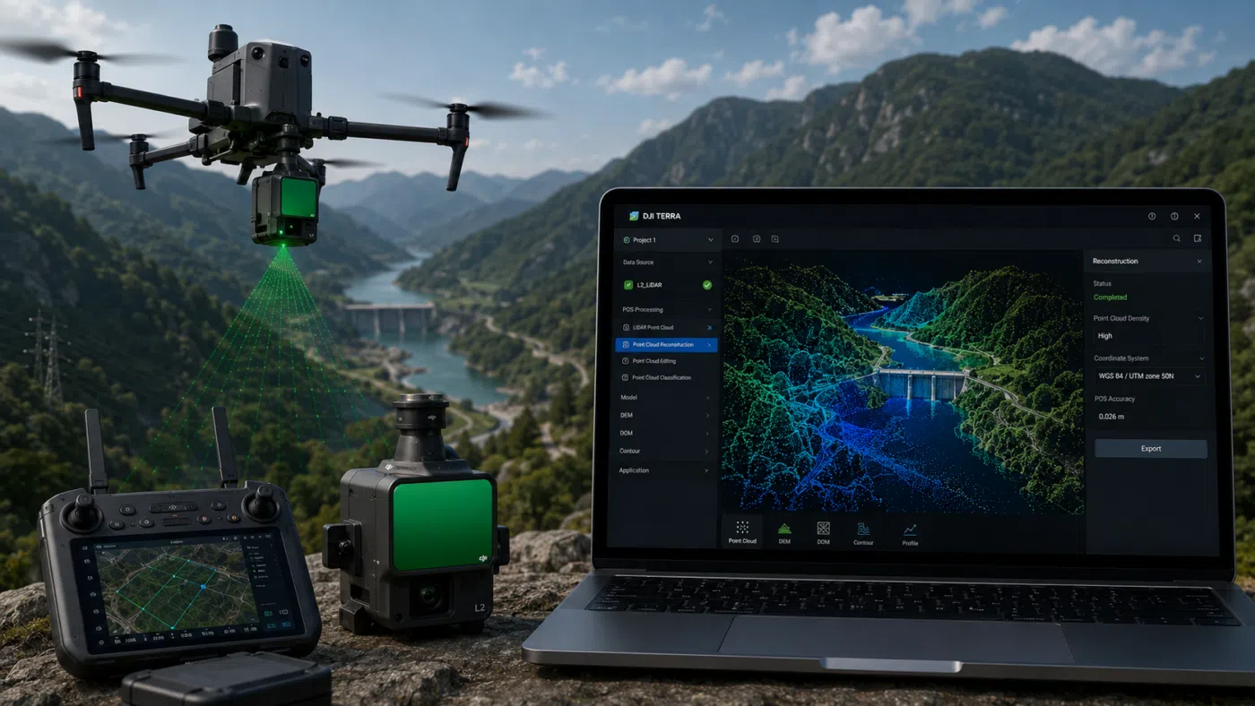
DJI Terra and Zenmuse L2 create one of the most practical LiDAR workflows available for drone surveying professionals. For surveyors, engineers, construction companies, forestry teams, mining operators and infrastructure inspection specialists, the combination of a DJI Enterprise drone, Zenmuse L2 and DJI Terra can transform aerial data capture into a complete 3D point cloud processing
06
May
May
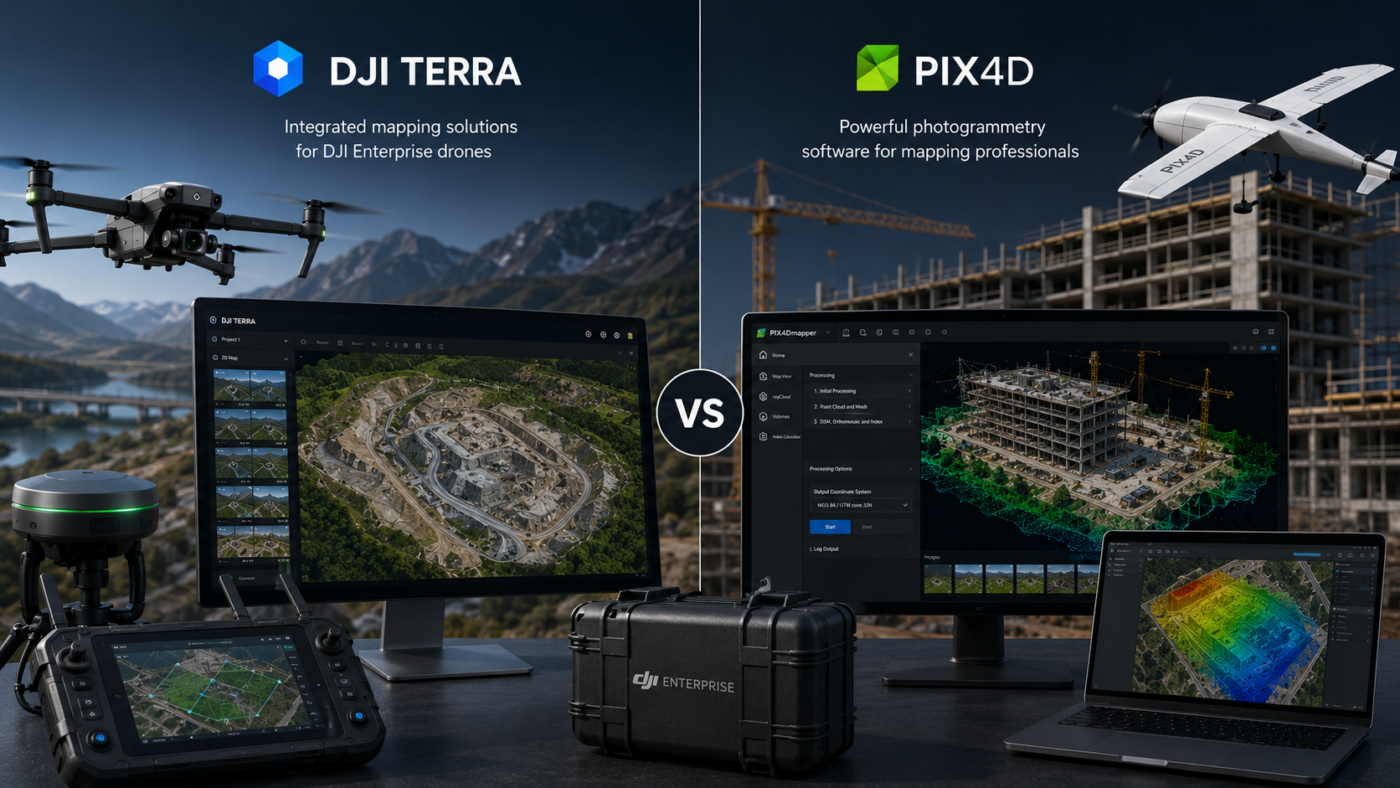
DJI Enterprise drone users often face an important software decision: should they process their mapping projects with DJI Terra or Pix4D? Both platforms are powerful, professional and widely used in drone mapping, surveying, construction, inspection, agriculture and geospatial workflows. However, they are built around different philosophies. DJI Terra is designed to work closely with DJI
- 1
- 2