

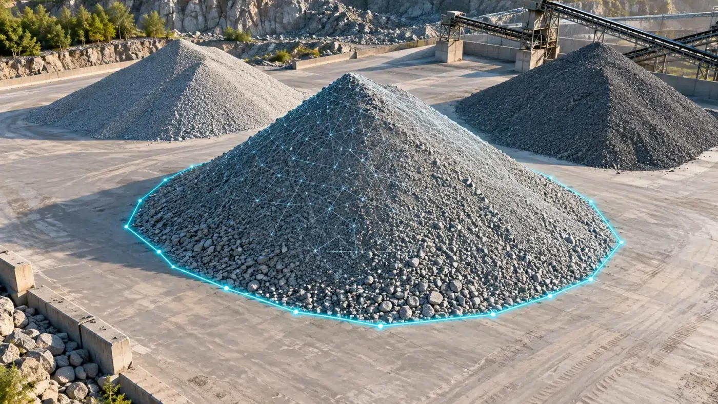
STOCKPILE INVENTORY & QUANTITY CHECKS
Turn a reconstructed stockpile into a quantity you can explain
DJI Terra stockpile volume measurement connects a drone survey with a practical inventory question: how much material is inside this pile? The useful result is a documented quantity based on a defined boundary and reference surface.
This guide explains a photogrammetry workflow, the base-plane choices, cut and fill interpretation, volume-to-mass conversion and a repeatable reporting method. It also identifies situations where a simple plane is insufficient.
What does DJI Terra measure when it calculates a volume?
A volume calculation compares the reconstructed surface inside a selected boundary with a reference below or through that surface. The upper shape may be visible in the drone photographs; the bottom of the pile usually is not. That makes the base assumption a central part of the measurement.
DJI defines cut volume as the portion above the selected base plane and fill volume as the portion below it. These are geometric outputs, not a statement that material has physically been excavated or delivered. Check the DJI annotation and measurement FAQ for the terminology.
The question to settle before flying
Are you measuring a free-standing pile on a known floor, material inside a bunker, or earthworks against an irregular design surface? These require different reference evidence. A neat 3D model does not reveal an unseen floor.
Plan the survey around the pile and its base
Begin with a short measurement specification. Record the pile identifier, intended units, required reporting interval and who will accept the result. Agree whether the quantity is for internal inventory, progress tracking or a contractual measurement.
- Capture the complete toe: include the transition from the pile to surrounding ground, rather than framing only its peak.
- Inspect hidden areas: walls, retaining structures and adjacent piles may conceal the base or prevent a clean boundary.
- Record activity: moving trucks and loading operations can change the pile during capture. Arrange a suitable survey window.
- Keep reference evidence: retain the floor survey, earlier empty-yard survey or other approved baseline where one exists.
- Define validation: identify independent checks and a suitable acceptance method before processing.
For repeat surveys, maintain a consistent spatial reference. Our accuracy, GCP and RTK guide explains control and independent checks. Review supported drones and sensors before choosing the acquisition system.
Capture and reconstruct a usable stockpile model
For this workflow, acquire sharp, overlapping visible-light photographs covering the pile and surrounding yard. Plan the flight in the appropriate capture application for your aircraft. Review side slopes and occluded areas, not just coverage in the top-down view.
DJI’s official stockpile workflow describes image capture, Terra reconstruction and measurement. Use it alongside the installed software documentation; controller menus and supported settings vary with the platform and release.
- Preserve the original images and survey records. Create a clearly named Terra project for the capture date.
- Import the dataset, review image quality and positioning information, and apply the project’s control workflow where required.
- Complete aerial triangulation and review the alignment before committing to the full reconstruction.
- Generate the 3D reconstruction used for measurement, then inspect the toe, slopes and peak from multiple viewpoints.
- Resolve missing coverage, obvious artifacts and moving-object effects before accepting a quantity.
An orthomosaic helps locate and identify piles; it does not by itself describe the full 3D surface. Our Terra outputs guide explains the difference between maps, elevation surfaces, point clouds and meshes.
Define the measurement boundary in DJI Terra
Open the reconstructed result and use Annotation & Measurement, then the volume tool. Trace the pile perimeter and finish the polygon according to the interface instructions. Place boundary points deliberately where the material meets the base, rather than on the slope or an unrelated object.
Give each measurement a stable name, such as Yard-A-Pile-03. Inspect the closed polygon before recording the result. If two piles touch, agree a repeatable dividing boundary and document it; otherwise, changes in the boundary can look like changes in inventory.
Select the required measurement units. DJI documents metric volume in cubic metres and imperial volume in cubic feet. Keep the displayed unit with every recorded number.
Make the boundary reproducible
Save a view showing the whole polygon and note any points placed on a wall, hardstanding edge or shared pile boundary. A reviewer should be able to understand why that area was included.
Mean plane or lowest point: choose a defensible base
Terra offers mean plane and lowest point base-plane choices. DJI’s measurement FAQ describes the mean plane as fitted to selected points, potentially tilted, and the lowest-point plane as based on the minimum elevation among those points.
| Situation | What to review | Why it matters |
|---|---|---|
| Free-standing pile with visible perimeter | Inspect whether perimeter observations reasonably represent the supporting floor. | A fitted plane is only useful when the selected points describe the intended base. |
| Pile against a wall or inside a bunker | Check known floor levels and the meaning of the lowest selected point. | The lowest visible point cannot establish the hidden floor shape. |
| Pile over irregular ground | Use a surveyed baseline and an appropriate surface-comparison workflow. | One plane may misrepresent depressions or changing slopes. |
| Earthworks against design | Compare the accepted surveyed and design surfaces using the specified method. | A pile annotation is not automatically a design cut-and-fill calculation. |
Do not select the option that produces the expected inventory total. Select the reference that represents the site, then record its limitations. Where a plane is inadequate, export suitable data for an approved analysis workflow and validate that result separately.
A practical example: base uncertainty and tonnage
Consider an illustrative pile with a plan footprint of 1,000 m². A uniform 0.10 m error in the assumed base can change the volume by roughly 100 m³, while the boundary and upper surface remain unchanged. This simplified calculation is area multiplied by vertical offset; it is not a measured Terra result.
This example explains why a stable floor reference can matter more than making the mesh visually smoother. Localized errors and sloping bases need a more complete assessment.
Converting cubic metres to tonnes
Use mass = volume × bulk density, with compatible units. For example, an illustrative 2,000 m³ volume and an independently established bulk density of 1.6 tonnes/m³ give 3,200 tonnes. The density is an assumption or measured input, not something established by the drone model.
Record the material, density source, moisture condition and whether the density describes loose or compacted material. Do not use solid mineral density as a substitute for the bulk density of a stockpile containing air spaces.
Check the result before reporting inventory changes
Review the quantity alongside the reconstructed geometry, the selected polygon and the base evidence. Useful checks include repeating the boundary placement, assessing plausible base alternatives and inspecting independent survey observations.
- A sparse or incomplete surface can miss important pile geometry.
- Vehicles or conveyors inside the boundary can contribute unwanted surface features.
- Changing the base choice between dates can create an artificial stock change.
- A different polygon can include neighboring material or exclude the pile toe.
- A mass difference may reflect an updated density assumption as well as a volume change.
Do not infer a fixed percentage accuracy from the presence of RTK or a low image reprojection error. Read our Terra quality report guide for the difference between processing indicators and independent validation.
For a time series, keep the pile identity and measurement method consistent and record any necessary change. If the floor changes or the pile relocates, update the baseline explicitly.
Prepare a stockpile measurement report that can be reviewed
DJI’s published workflow includes saving annotations and exporting an XLSX measurement record. Use the software output as the starting point, then add the context needed by the inventory team.
- Site, pile ID, material and survey date.
- Volume with units, boundary view and base-plane choice.
- Reason for the selected reference and any hidden-base assumptions.
- Capture system, software version and relevant quality evidence.
- Bulk density and its source if reporting mass.
- Comparison date and explanation of changes in method.
- Reviewer, acceptance status and any outstanding limitations.
Keep the native project, original capture files and report together under a stable revision. The report should distinguish measured geometry, assumed inputs and derived quantities.
DJI Terra stockpile volume measurement FAQ
Can DJI Terra calculate stockpile volumes?
Yes. Its annotation and measurement workflow supports volume measurement against a selected base plane. Establish the pile boundary and base evidence before using the number for inventory.
Does the cut volume mean material has been excavated?
The term describes the portion of the model above the reference plane. For a stockpile, interpret it in the context of the selected boundary and reference; it is not evidence of an excavation event.
Can I calculate the weight directly from the drone model?
The model provides geometry. A mass calculation also requires an appropriate bulk density and compatible units. Keep that additional input and its uncertainty in the report.
Is a lowest-point base always correct for a bunker?
No. Check the actual floor geometry. A visible low point does not establish the level or slope behind material or a wall.
Do I need a separate Terra license for every stockpile?
Select the software entitlement around the reconstruction features and operating setup, rather than the number of measured piles. Review our license guide and confirm the intended workflow before purchase.
Build a repeatable stockpile processing workflow
Tell us your drone, site type and required deliverables. We can help you check the Terra reconstruction and licensing requirements before you set up the workflow.
Official documentation
- DJI stockpile capture, processing and annotation workflow
- DJI annotation and measurement definitions
- DJI Terra manuals and release documentation
Independent guide by Drone Emotions. Documentation reviewed on 9 October 2026. Consult the documentation for the installed software and capture-system releases.


